If you’re heading out into the mountains, being able to navigate is absolutely essential. Google Maps will not work while you’re up there so you will need to find a much more dependable method. Map & compass will always win hands down in terms of reliability however there are simpler ways such as using one of the many apps out there. To name few: Garmin, AllTrails, Outdooractive and my absolute go to – OS Maps.
I’m going to talk you through the key points of using OS Maps, these won’t all be relevant if you use one of the other apps but the basics will remain the same. There is a lot more that I could go into but I decided to keep it simple otherwise we could be here all day!
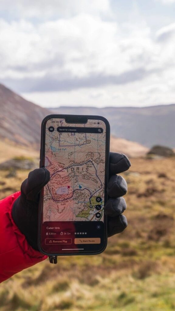
Before you head out, make sure you download the map you are planning to follow because if you lose signal you may well lose the map too.
So how do you know where you can walk? I use the paid version of the OS Map App which is a lot more detailed. On the 1:50 000 scale they are marked in magenta but if you zoom in to 1:25 000 scale the public rights of way are marked in green. Wherever you see one, you are allowed to walk but when walking through owned land, make sure you stick to them.
The majority of the mountains within the Brecon Beacons as well as most national parks in England & Wales will be open access land meaning that you are free to walk off these paths, across privately owned land. Open access gives you the chance to walk freely, explore wild, open landscapes and find your own way. This type of land will be marked in the app as a sort of a yellow wash colour. Look at the background colour of the image of Pen y Fan.
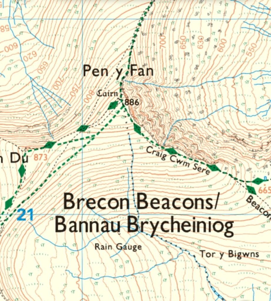
Contour Lines
Contour lines are basically a way of being able to tell the lay of the land, essentially what sort of gain / loss of elevation you have ahead of you. They will give you an insight into the hike you have planned and also the likely duration. For example, the more uphill / steep sections there are, the slower you will likely be.
Now, how to read them. A contour line is usually a brown / orange colour and they are drawn along points of equal height, so if you were to walk exactly along any contour line, you should stay at the same elevation all the way around. The closer together they are, the steeper the terrain. They usually are 10 metres apart but change to 5 in flatter areas.
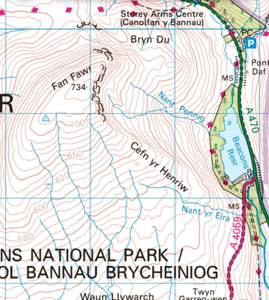
If you take a look at the image of Fan Fawr, you can see just how steep the hike is but as the saying goes, the best views come after the hardest climbs.
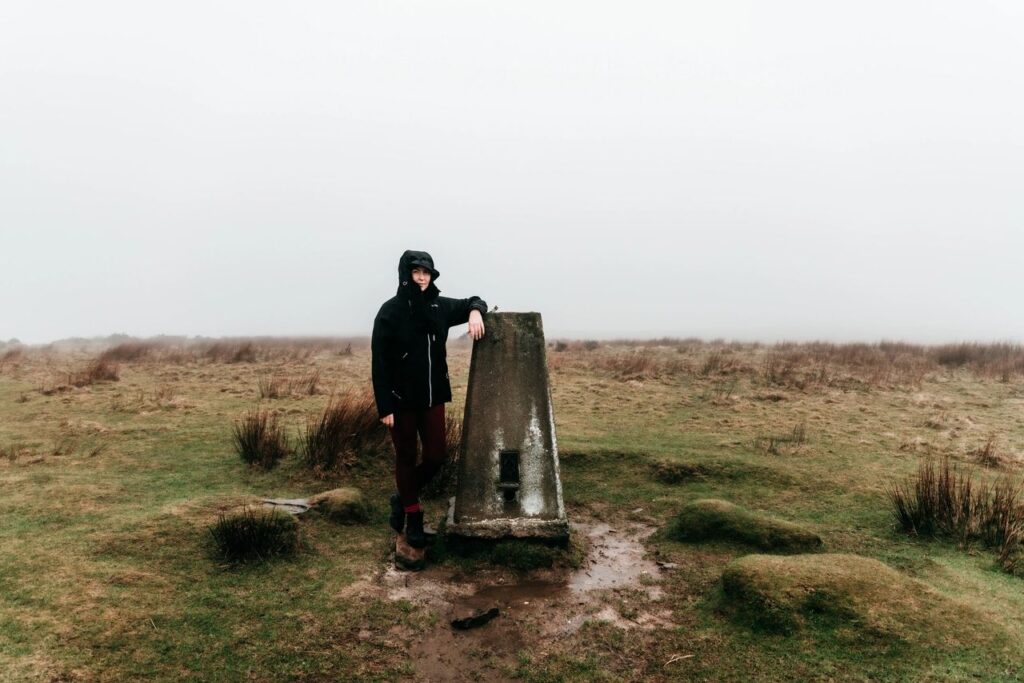
Trig Points
Have you even climbed a mountain if you haven’t had a photo on the trig? But what is a trig? To go by its correct name, a triangulation pillar was used by Ordnance Survey in order to map the exact shape of the country. A theodolite would be placed on the top of the pillar and pointed at one of the nearby trig points et voila, accurate angles between pairs of trigs could be measured.
They are marked on maps as little blue triangles and are usually found on the highest ground in a particular area.
Just remember, practice makes perfect. There are so many courses out there if you want to learn more or just drop me a message with any questions and I will do my best to help 🙂